

Upstate Trails Map Launched
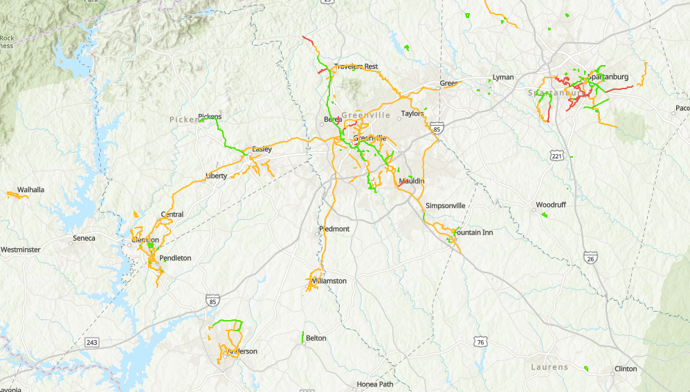
The Upstate Mobility Alliance (UMA) has partnered with the Upstate Greenways & Trails Alliance (UGATA) to launch a new mapping tool meant to help advocates and communities plan for the expansion of pedestrian/bike paths across the Upstate.
Sourced from dozens of local planning documents, construction updates, and finished trail data, the Upstate Trails Map allows users to view trail routes that are planned, in process, shovel ready and/or complete.
Meant to be used as a resource for on-the-ground planning and awareness, the map also highlights the growing connectivity planned and in place across the 10-county region of the Upstate.
The map is live on UMA’s website and accessible for free. The map is also continuously updated as new plans and projects are published.
Need some more info?
The webinar announcing this partnership is available for public viewing at the link below through April 30.
View Zoom Recording >>
Passcode: 2TqhfF!E